American FactFinder: Geo within Geo
A great deal of census data is available through American FactFinder. The custom table interface allows you to retrieve a single table containing exactly the data you want. To obtain data for many locations within another location, use the easily-overlooked “geo within geo” selection method to avoid the tedium of retrieving and combining separate tables for a group of locations.
As an example, I’ll show you how to retrieve the year 2000 population by age and sex for each block in Broome County, NY.
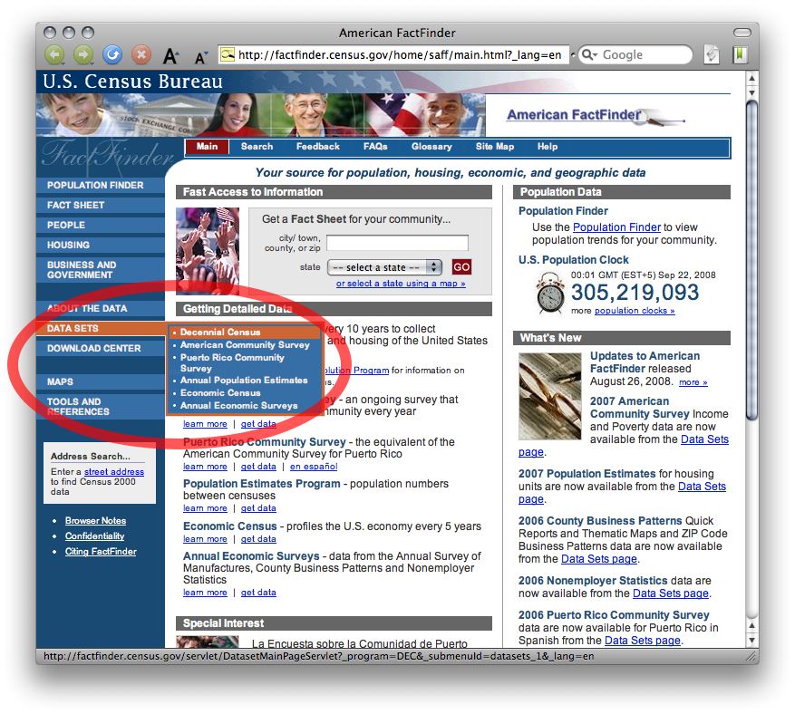
First, select Decennial Census from the Data Sets menu at factfinder.census.gov:
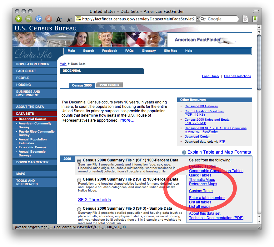
Then select Custom Table from the Census 2000 Summary File 1 category:
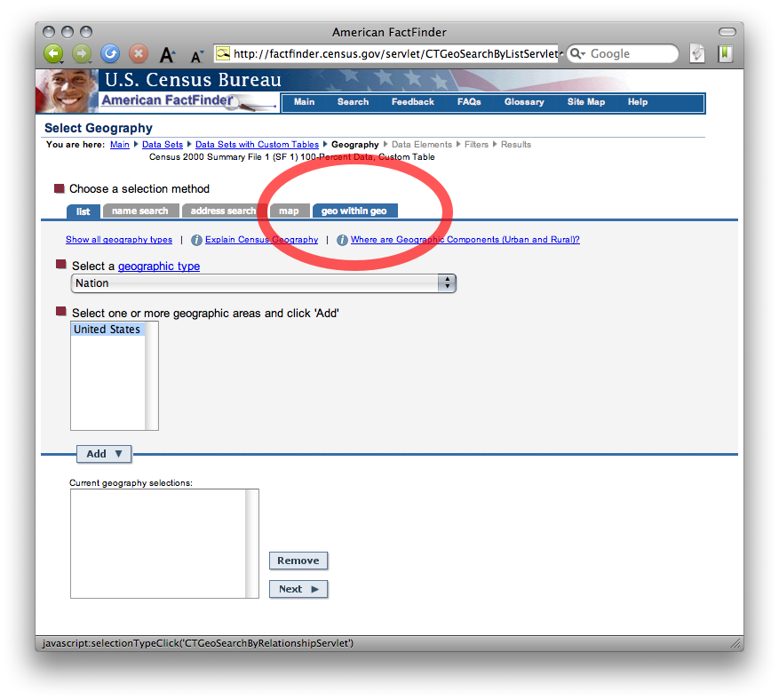
Here’s the important step. Click the geo within geo selection method tab:
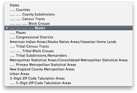
Choose Blocks from the Show me all menu (your table will contain data at this resolution):
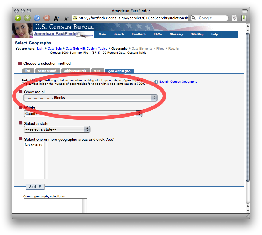
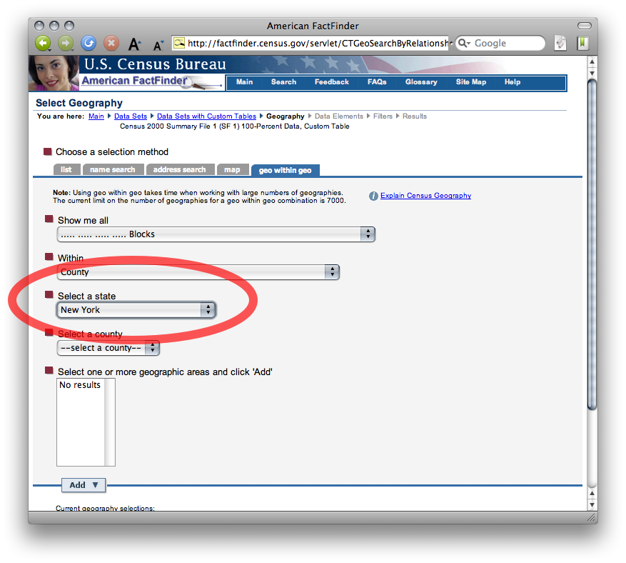
By default, the table will contain all block groups within a county. Select New York and Broome County from the following menus to select which county:

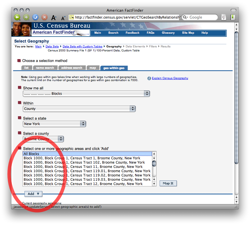
Select All Blocks from the list of blocks in Broome County and click Add:
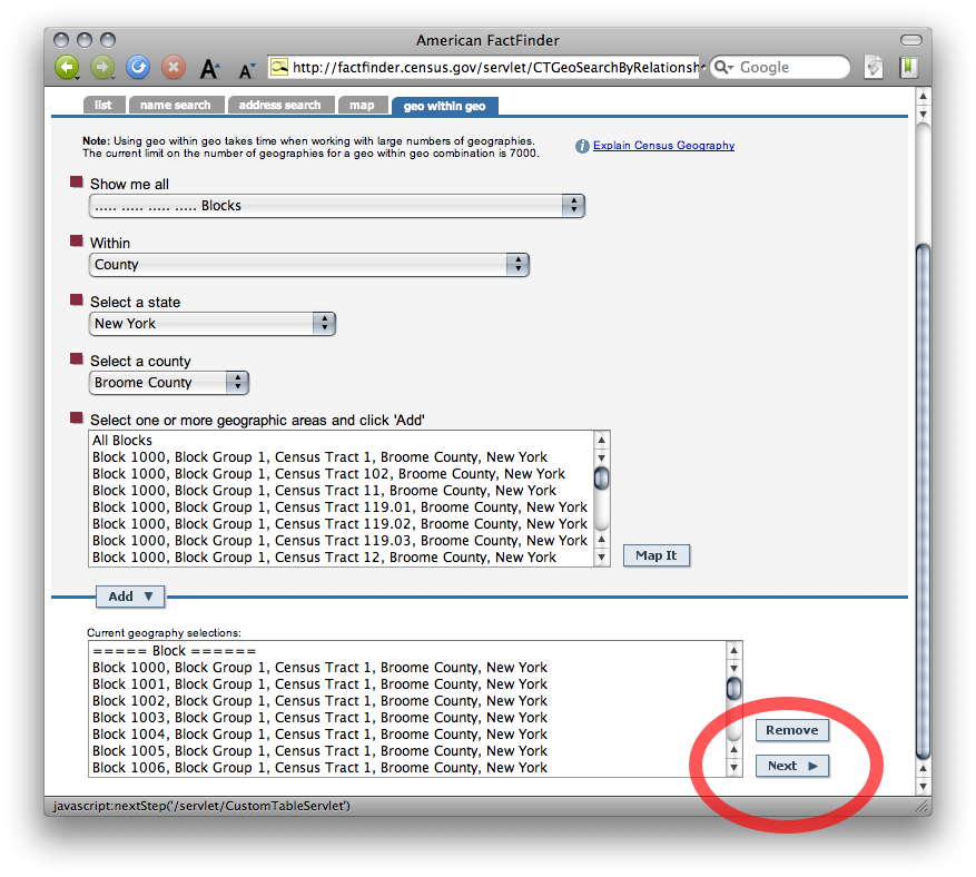
Now that you have defined the enumeration units and area of interest, click Next to choose your variables:
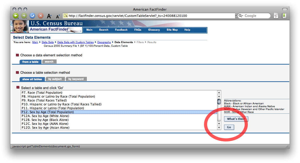
Select P12 Sex by Age (Total Population) from the list of tables in Summary File 1 and click Go:
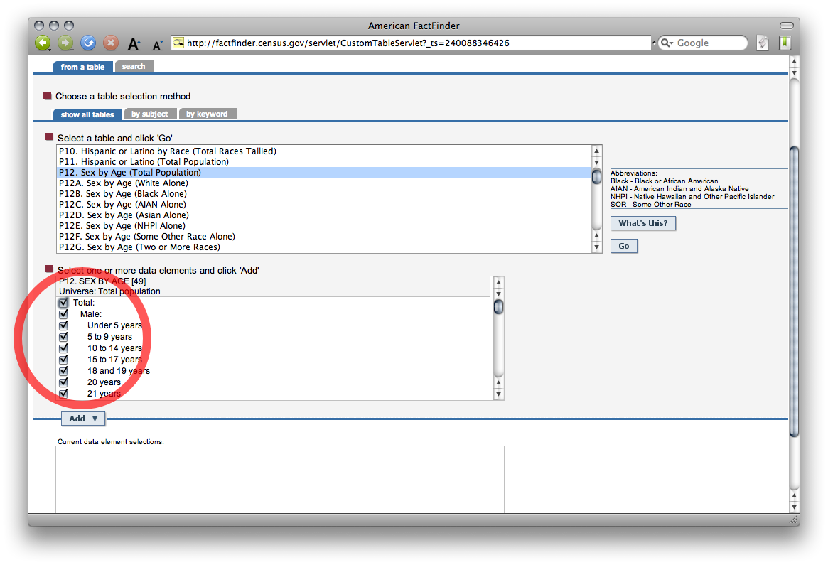
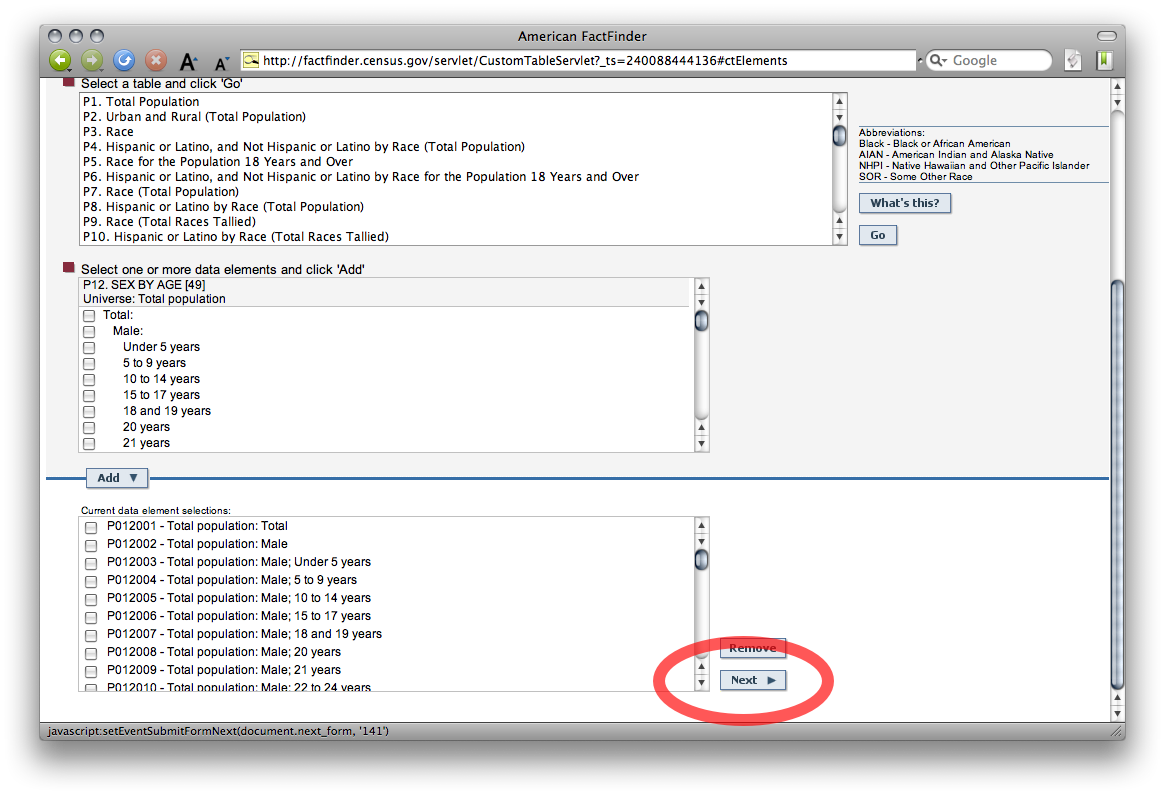
Check which variables you want from table P12 – all of them. Click Add, then click Next to proceed:
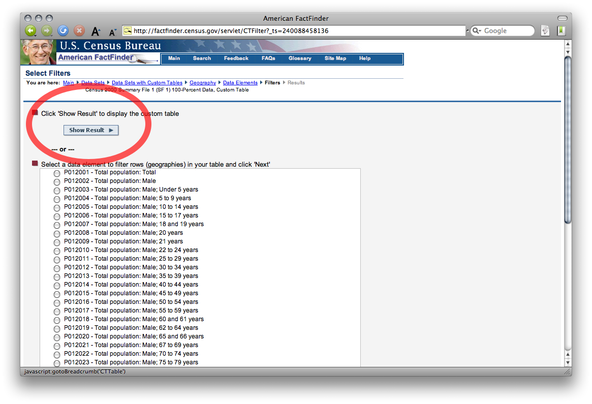
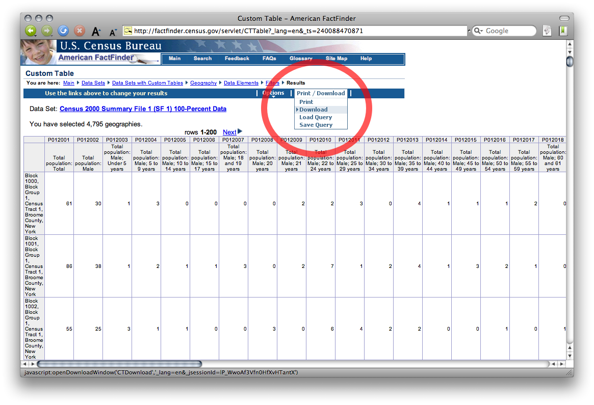
Click Show Result to display the table (this may take a few moments):
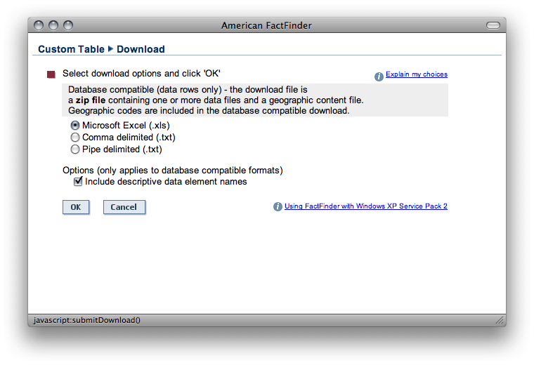
Lastly, choose Download from the Print/Download menu to obtain the table in spreadsheet form:
How you use the data is up to you. Perhaps you’ll use dbfjoin to map it with an appropriate shapefile from the Census Bureau’s TIGER/Line repository. (Users of pro GIS tools don’t need dbfjoin, but I’m bringin’ it to the streets!) Alternatively, you might want to plot the age/sex composition of a few blocks with Population Analyst. Stay tuned for more bargain-bin demography and cartography.
Posted on Sunday, September 21st, 2008. Tags: geography.
One Response to “American FactFinder: Geo within Geo”
Posted by Ian on Tuesday, September 23rd, 2008 at 8:48 PM.
For users of census boundaries, road centerlines, and generic POI shapefiles in general, ESRI’s StreetMaps Pro data set (which comes free with ArcView) is a good alternative to TIGER shapefiles. The contrast between TIGER roads and the Tele-Atlas streets in the StreetMaps data is substantial. An ArcView license is a steep price for some data, but if one already has a copy of the ESRI software, requesting a StreetMaps DVD delivers some added value.
-Ian