CB Shapedraw
Now at https://github.com/anoved/Chipmunk-Basic-Stuff/tree/master/Shapefiles
An ESRI Shapefile renderer implemented in Chipmunk Basic
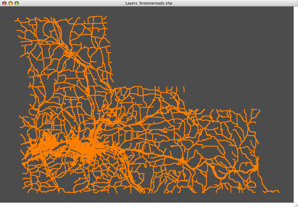
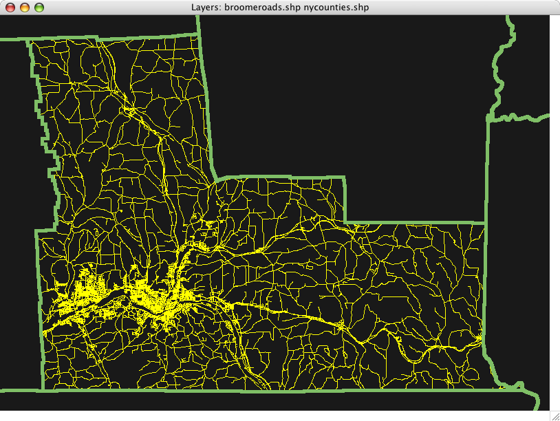
This Chipmunk Basic program parses ESRI shapefiles and draws their contents to the Chipmunk Basic graphics window. It supports point, multipoint, polyline, and polygon shape types. Multiple shapefiles can be drawn together using different line weights and colors, allowing simple map overlays to be constructed.

Speed and Significance
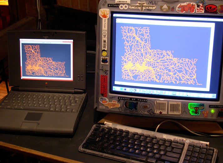
Although cb-shpdraw is very slow and has little practical utility, it is the only freely available way I currently know of to display shapefiles on old 68k Macs such as the PB 540c used for the Classic screenshots on this page. It is a couple orders of magnitude slower on the 33MHz 68LC040 than on my 1.2GHz G4 (as in half an hour versus half a second)! But that is OK, as it is mainly a “can it be done?” program, not an actual tool.
Interface
The current interface is crude. Here is an example command transcript and its output (“>” is the Chipmunk Basic console prompt):

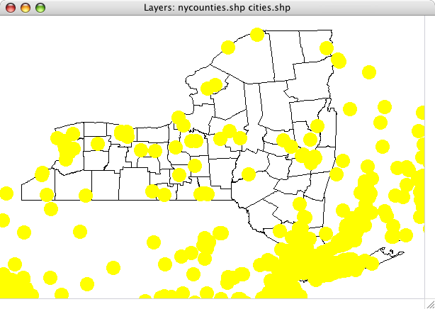
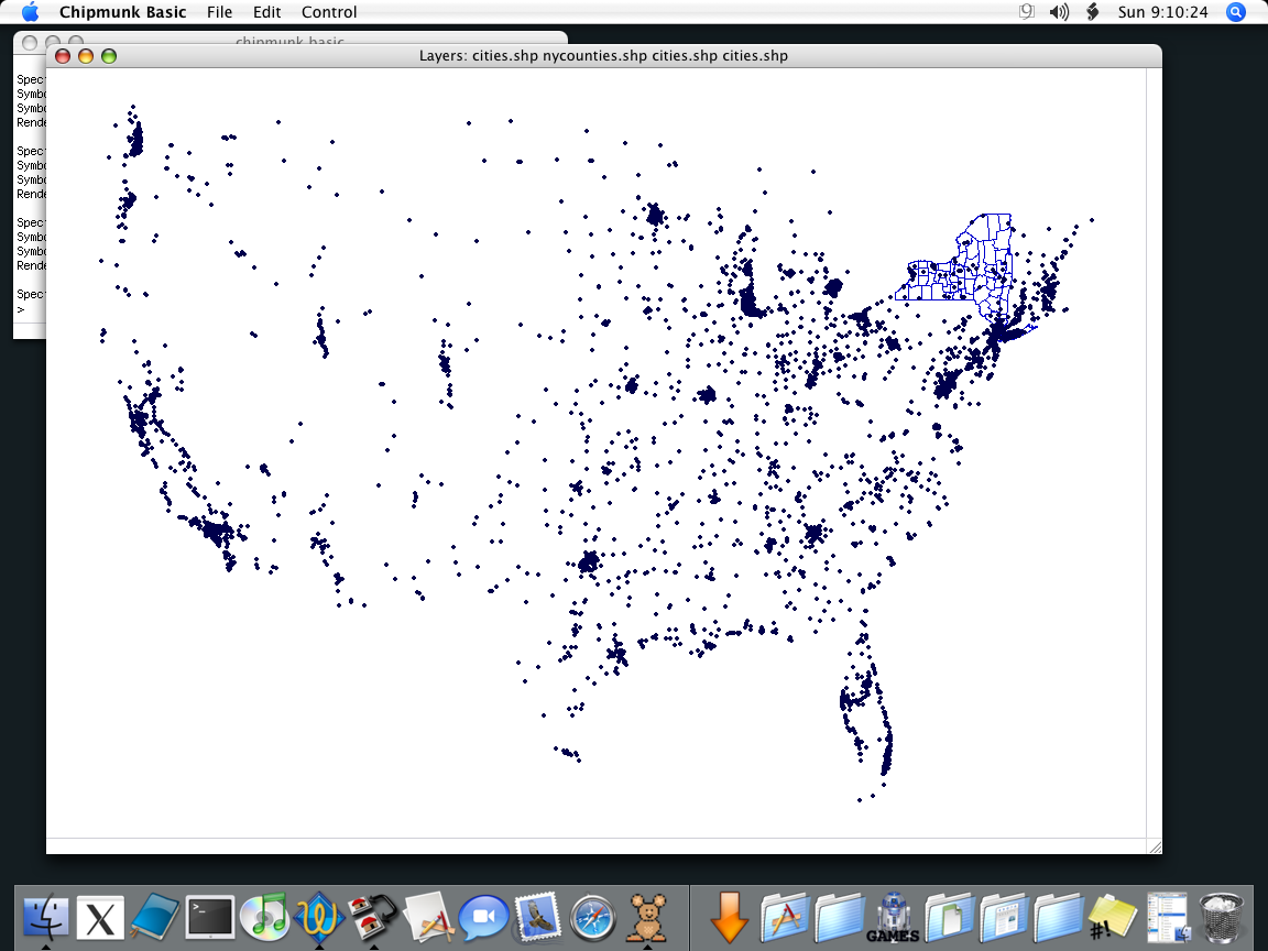
>run Enter window width: 600 Enter window height: 400 Enter window color (r,g,b percents): 100,100,100 Specify shapefile (none to stop): nycounties Symbol color (r,g,b percents): 0,0,0 Symbol size (>=1): 1 Rendering polyline or polygon shapefile Specify shapefile (none to stop): cities Symbol color (r,g,b percents): 100,100,0 Symbol size (>=1): 20 Rendering multipoint shapefile Specify shapefile (none to stop): > The shapefile names stated above are the names of shapefiles residing in the same directory as the cb-shpdraw.bas program. To reference a shapefile in a different folder you have to enter its path. On Mac OS X, that looks like this:
Specify shapefile (none to stop): /Users/anoved/Documents/Geo/shapefile.shp On earlier systems, I believe the directory separator is the colon (“:“).
Shapefile names
Shapefiles actually consist of three separate files: a .shp file containing the coordinate data, a .shx file that provides an index to the coordinate data for each shape, and a .dbf file that contains attributes associated with each shape. Each part of a complete shapefile has the same prefix. When specifying a shapefile for cb-shpdraw, you may provide the name of the .shp file, the .shx file, or the shapefile prefix alone. The program doesn’t do anything with attribute files and doesn’t even require them to be present.
Scaling and Coordinate Systems
The first shapefile rendered establishes the scale used for all subsequent layers. It is stretched to fit within the requested window dimensions, and the formula used to convert its geographic coordinates into screen coordinates is applied to any additional layers. This only results in meaningful overlays (such as the examples pictured above) if the shapefiles use the same coordinate system (latitude/longitude or UTM, for instance). Mixing coordinate systems is no problem in a real GIS that can reproject layers on the fly, but cb-shpdraw doesn’t know anything about projections, let alone translating them dynamically.
Nifty features
Although cb-shpdraw doesn’t do much itself, the code does demonstrate how to do a couple interesting things with Chipmunk Basic.
- unnumbered lines
- catching and handling
openerrors usingon error(theopencommand’s optional “else goto” error handler appears to be incompatible with labelled goto targets; it’ll only go to a hard-coded line number – blah!) - use of the
fseekcommand to navigate around a file (not put to terribly effective use incb-shpdrawas the shapes are drawn sequentially anyway, but in place to facilitate future modifications where particular shapes are requested but not others – possibly according to attribute values) - use of named subroutines
- parsing of a fairly complex binary file format – in accordance with ESRI’s specification, shapefiles contain a combination of “big endian” and “little endian” byte ordering. This means that some values are stored “backwards” (most, actually, relative to the Mac’s native “big endian” byte order), which is the reason for the byte-by-byte math in the
Readsubroutines. Otherwise, input could probably be lots faster, usinggetto read atyped structure directly from file. Maybe that’s possible anyway. Regardless, figuring out how to read a little-endian eight-byte double with Chipmunk Basic seemed pretty tricky.
Wish list
Not necessarily a to-do list.
- arbitrary scaling/”zoom”
- maintain proper vertical orientation (some shapefiles may represent northerly latitudes with decreasing Y coordinates)
- improved interface, possibly using more GUI commands
- SPEEEEEEEED
- filled polygons (currently only outlines are drawn – no built-in
graphics polygoncommand) - polygon part recognition (shapefile polygons may consist of multiple parts, typically representing holes or ‘islands’ within the main shape; sub-parts should be drawn with new lines, not connected to the previous part)
- attribute parsing (the DBF format is ugly, but if it could be read then this could almost start to have some useful functionality, such as drawing only those shapes whose attributes match a certain criteria)
- extent checking – pay attention to shape extents and don’t bother drawing those that fall outside the view window (ie, for secondary layers that cover a larger area than the primary layer, as with the yellow-dot example above)
- utilize the built-in
bigendianboolean variable?
I encourage other Chipmunk Basic enthusiasts to tackle these or other tasks themselves.
Download
Download cb-shpdraw 1.0 [6k] completely unsupported and definitely not guaranteed
The download package contains two files, cb-shpdraw.bas and cb-shpdrawz.shp. The first is the regular version, containing lots of white space and a good deal of comments. The second is my attempt at optimization for an interpreted language; I basically stripped out everything what wasn’t code and condensed the code itself as much as possible. I don’t really know how big a difference this makes, if any, so if I decide it’s too confusing to look at I may remove it.
I also recommend trying my Chipmunk Basic syntax coloring modules, as they will make the code look much more readable. In fact, here is a PDF version of the code showing what it looks like with fully colored syntax.
cb-shpdump is cb-shpdraw‘s textual predecessor. It does what the Shapelib’s shpdump program does, only slower! The code is very similar to cb-shpdraw‘s, except coordinate data is printed to the console instead of drawn in the graphics window. Only interesting difference is it’s compatible with the OS X command-line version of Chipmunk Basic (runs much faster than in the windowed version). Appropriately, the first argument is an obscure “mode” string, where h means to print the file header, s means to print each shape’s header, and g means to print all the geographic coordinates for each shape. So, cb-shpdump h shapefile.shp just displays the file header, while cb-shpdump hsg shapefile.shp print everything.
Finding shapefiles
There are a lot of useful shapefiles available for free. Here are some starting points:
- National Atlas “Raw Data”
- US Census Cartographic Boundary Files
- Cornell’s Geospatial Info Repository (largely NY-specific)
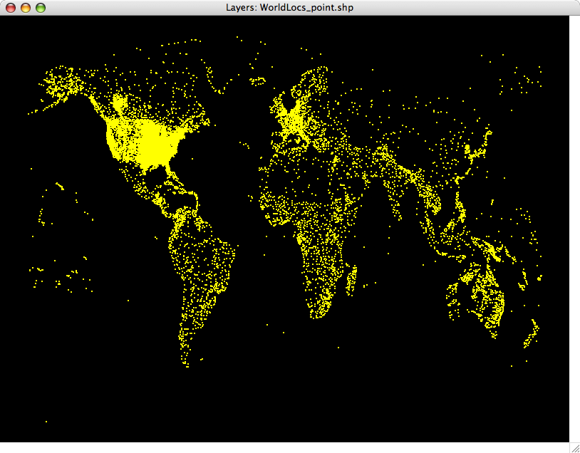
>run Enter window width: 800 Enter window height: 600 Enter window color (r,g,b percents): 0,0,0 Specify shapefile (none to stop): WorldLocs_point Symbol color (r,g,b percents): 100,100,0 Symbol size (>=1): 2 Rendering single-point shapefile